Tag Archives: outdoors kenya

3-Day Hiking Itinerary: Western Aberdare Range

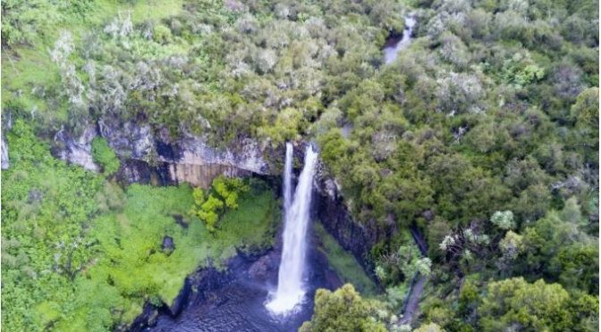
The objective of this hike is to spend three days exploring the western side of the Aberdare Mountain Range with ultimate fulfilment of reaching the Karuru Waterfall. It is an excellent route for hikers looking to acclimatise in preparation for a Mount Kenya or Mount Kilimanjaro trek, thanks to its steady altitude gain and varied terrain.

Location Aberdares
Starting Point Kahuruko forest gate
Ending point Kahuruko forest gate
Walking Duration 3 days
Terrain Motorable road or mashes
Difficulty Easy
Elevation gain 600m and 300m


Day 1: Kahuruko Forest Gate to Mutubio Park Gate

The hike begins at the forest gate in Kahuruko. After lacing up your boots, you follow the tarmac road leading up to the park gate.

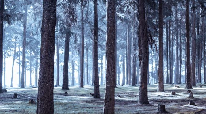
The trail starts through an afforested section managed by the Kenya Forest Service (KFS), which soon transitions into dense bamboo forest. As you progress, the road becomes quieter and more challenging, meandering steadily uphill.

You will climb from approximately 2,600 metres above sea level to about 3,200 metres. The gradual ascent makes this a good acclimatisation stretch.

Overnight: Pitch camp at Mutubio Park Gate.


Day 2: Moorland Exploration and Karuru Area

From Mutubio Park Gate, walk down a motorable road for about half a kilometre, then turn right into the moorland.

The terrain opens up as you descend gently toward a catchment area that feeds a tributary of the Karuru River. You will follow animal trails along the edges of this landscape until you reconnect with a road.

Once back on the road, continue walking until you reach the campsite. After a short rest, proceed down a steep path leading to a series of bridges crossing crystal-clear streams. From here, climb up to the viewpoint for spectacular scenery.

Alternative Route:
Instead of descending into the moorland, you can remain on the motorable road from the gate until you reach the first right turn. Follow this path to the campsite and continue onward to the viewpoint.

After exploring, return to Mutubio Park Gate.

Overnight: Camp at the park gate.


Day 3: Descent to Kahuruko

Begin your descent early in the morning. The return journey covers approximately 10 kilometres back to Kahuruko Forest Gate.

The downhill trek is easier but still requires caution, especially in wet conditions.


Guiding

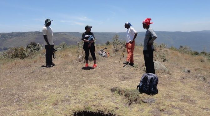
  • Kenya Wildlife Service (KWS) rangers are required for this hike.

Fees

  • Standard KWS park entry fees
  • Standard KWS ranger fees

Getting There

By Public Transport:

  • Take a matatu heading to Kahuruko.

Hiking the Aberdare mountain range, Kenya

The Aberdare is a mountain range. Being a range, it offers numerous ridges, peaks, valleys and rivers to challenge the peak bagging hikers, professional climbers and outdoor enthusiasts. Most of the mountain range is a National Park under the Kenya Wildlife Service (KWS). It is therefore subject to the normal entry requirements and charges. Some parts are under the management of the Kenya Forest Service (KFS) and are subject to the KFS regulations and requirements.

Aberdares is generally open to walking in the moorland zones, but the rainforest areas have plenty of wildlife and could be dangerous. If contemplating trekking the Aberdares, it is best to enquire at the KWS Park Headquarters in Mweiga regarding any limitations or recommendations, especially regarding armed escort. Established hiking groups and tour operators also may know where to walk and where not to.

The Aberdares’ main attractions to the hiker are the:

Mountain peaks

Satima

Oldoinyo Lesatima, or Satima, is the highest peak at 3999 m asl. It has three main trails. The Wandare gate trail, the Shamata gate trail and the Olborosat trail.

Kinangop

Kinangop at (3906m asl) is the second highest peak. It has two trails: the Njabini gate and the Mutubio gate trail.

Elephant hill

Is the third highest. It has one trail from Njabini.

Kipipiri

Is the 4th highest peak at 3348m asl

Despair hill

This is the 5th highest peak and is often tackled as part of the Despair Hill-Elephant Hill-Kinagop Peak trek.

Forests

Three main distinct ecosystems within the Aberdare Mountains change drastically with altitude: the dense rainforest where most of the wildlife is, which gives way to dense bamboo forests, which in turn give way to the beautiful high moorland with sub-alpine vegetation.

Caves:

Popularly referred to as Mau-Mau caves, overhangs are dotted all over the mountain ridge. They serve as shelter to the hiker and honey gatherers and help do away with the need to carry tents.

Waterfalls

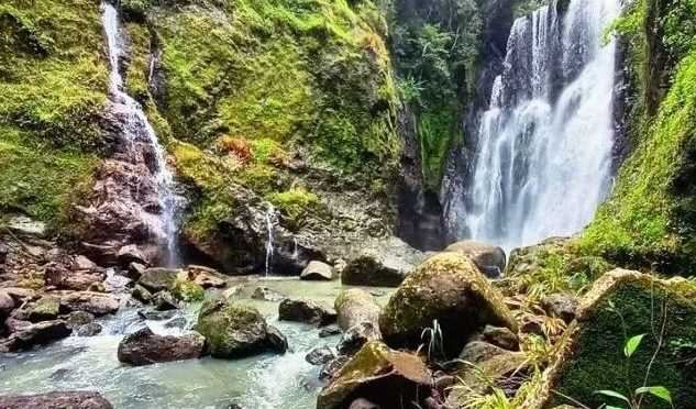
The park is home to several spectacular waterfalls, including the

Chania Falls –

Karuru Falls

-With a total height of 273 m. It occurs in three steps of 117 m, 26 m and 130 m.

Zaina

Ragia nos. 18 and 17

Gura Giant Falls at 305 m

Ragia Forest-Sasumua River Hiking Trail


The objective of this hike is to traverse the bamboo section of Ragia Forest, descend into the deep valley of the Sasumua River, and visit Waterfalls 17 and 18 before climbing back out.

Location: Njabini
Starting Point: Ragia Forest Gate
Ending Point: Ragia Forest Gate
Walking Duration: 6 hours
Terrain: Slippery animal trails through thick bamboo forest
Difficulty: Moderate
Elevation: Lowest: ___ | Highest: ___

The Ragia Forest trail may start either from Ragia Forest Gate or from Sasumua Dam, depending on the route taken from Njabini. The hike begins along a motorable road that skirts the fringes of Sasumua Dam, which supplies water to Nairobi. Along the way, you are treated to spectacular views of Elephant Hill.

Bamboo Trail

About one kilometre from the dam, the trail leaves the motorable road and enters thick bamboo forest, where you follow animal trails until reaching a clearing that marks the water pipeline wayleave. The struggle through the bamboo eases briefly before the guide suddenly turns left into the dense bamboo once again. The challenging section ends abruptly as the trail drops steeply and the bamboo gives way to rainforest.

From Boots to Butts

Two-Metre Drop into the Sasumua River

During the rainy season, the trail can be extremely slippery, and many hikers give up using their boots and resort to sliding on their butts. As the roar of the waterfall grows louder, the trail drops vertically about 2.5 metres into the Sasumua River. From there, you enjoy a short but exciting river walk to the magnificent Ragia Waterfall (Waterfall 17).

Your camera comes in handy on the centre rock.

Having a Closer Look

The return journey is just as dramatic. While gravity assists the descent, it works against you on the climb back. Butts are replaced by knees and hands (sometimes ladies remember they haven’t visited the manicurist for a while). Once you reach the wayleave, you can decide whether to continue to Waterfall 18 or return to the forest gate.

The Crossing

Getting There

Public Transport

From Nairobi, take a matatu to Njabini from the junction of Keekorock Road and the Nation House roundabout. Alight at Njabini town. At the Njabini matatu stage, you can easily negotiate for a matatu to Sasumua.

Private Transport

Drive towards Njabini and turn right just before the Sasumua River bridge. Continue for approximately four kilometres to the forest gate.

Entry Charges

Category Charge (KSh)
Residents 200
Non-residents 600
Guide fees 2,000 (per group of up to 10 people)
Armed escort 3,000
Camping

Guide

  • Local community organisation
  • Kenya Forest Service

Please make prior arrangements.

Kijabe Hill – Kinari Ridge


Location Mai Mahiu/Longonot
Starting Point Mai Mahiu – Longonot road
Ending point Soko mjinga or Flyover
Walking Duration 9-10 hours
Terrain grazing tracks
Difficulty Moderate
Elevation gain 650m

The Objective

This hike is all about movement—crossing from the old Nairobi–Nakuru highway to the new one. It is a journey of ups and downs. You climb Kijabe Hill, descend its eastern slope, then take on the long pull up Kinari Ridge before finishing at the new highway.

It sounds straightforward. It is not.

This hike suits a moderately paced hiker. Mixing slow and fast hikers often leads to one common mistake—reaching the Kinari forest at dusk. That is something you want to avoid.


The Trail: Kijabe Hill to the Railway Crossing

The route begins by following the Kijabe Hill trail up to the second railway crossing. Along the way, the old Lunatic Express snakes around the hill in wide, lazy curves—a reminder of the engineering madness that carved this path through the escarpment.


The Climb to Kijabe Hill Peak

The hike starts about 9 km from Mai Mahiu, just after the unmistakable IDP settlement. At 2,010 metres above sea level, the air already feels thinner.

Then the climb begins.

For the next two to three hours, you grind steadily uphill. No shortcuts. No tricks. Just step after step.

At 2,659 metres, you finally reach the peak.

You rest, take photos and breathe. You do what hikers do mid-hike where theres is not bathroom.


The Descent: Farms, Forest, and the Lunch Spot

From the peak, you drop down the eastern slope. The descent is quicker but no less demanding.

You pass the paragliding launch point—where others choose to fly instead of walk. Then come scattered farms and homesteads, before the trail dips back into forest.

Eventually, you reach a point near the railway line—your lunch stop.

By now, you have descended about 467 metres to roughly 2,192 metres above sea level.

If your timing is perfect, you will enjoy lunch under the trees.

It rarely is.


Along the Railway and Up Kinari Ridge

After lunch, you drop a few metres to the railway line. Then you follow it north for about 200 metres, just past the station.

This is your last easy stretch.

After a short breather, the real work begins again—the climb up Kinari Ridge.


The Kinari Challenge

Kinari does not give itself easily.

During the dry season, the trail is clear and forgiving. But in the rainy season, the bush fights back. Paths disappear. Tracks split. Progress slows.

You push through overgrown vegetation, following faint grazing trails, guessing your way forward.

Then suddenly, the bush opens up.

Wide stretches of Kikuyu grass roll ahead. You cross them and enter the cool, shadowy Kinari forest.

From here, the trail leads you toward Soko Mjinga—also known as the flyover.


Sunset and Soko Mjinga

If the weather is kind, the escarpment rewards you with a breathtaking sunset. The sky burns orange and gold as the valley falls into shadow.

It is a moment worth the effort.

Then you descend to Soko Mjinga, where roast maize often awaits.

But be warned—the name is not accidental.


Requirements

  • Guide fee
  • Forest charges

Guiding

Guides can be arranged through KENVO.

If you want, I can tighten it further, add a map-style route summary, or inject more humor like your Hell’s Gate piece.

Kijabe Hill Hiking Trail


Location Maĩ Mahiũ/Longonot
Starting Point Mai Mahiu – Longonot road
Ending point Mai Mahiu – Longonot road
Walking Duration 5 hours
Terrain Grassy uphill and motorable road
Difficulty Easy
Elevation gain 650m over 3km


Few people will tell you the name of the hill near Mai Mahiu in Nakuru County. This is because Kijabe Hill lost its name when Kijabe School relocated from the foot of that hill to its current location in the Eastern Escarpment of the Great Rift Valley. Kijabe Hill rises quietly north of Mai Mahiu—Maĩ Mahiu, if you want to get it right. It means “hot water,” and around here, vowels matter. Change them, and you could be saying something entirely different.

From the road, the hill does not look dramatic. Not like Longonot. Not like Suswa. It sits there, almost modest. But do not be fooled. Kijabe does not shout. It tests.

The plan is simple. Climb to the top. Cross over. Loop back to the Mai Mahiu–Naivasha road. On paper, it is a short hike—just over 3 kilometres to the summit. For a beginner, that translates to three, maybe four hours of steady effort.

Simple, yes. Easy, no.


The Beginning: A Gentle Lie

The hike starts about 9 kilometres from Mai Mahiu, roughly halfway to Longonot town. At 2,010 metres above sea level, the air already feels a little thinner, a little cleaner.

You set off heading north. The trail rises immediately, but it is kind at first, straight and predictable.  You fall into rhythm and out of breath.  Soon, the railway line appears. It slices across your path like a quiet checkpoint. This is where you pause. Turn back. Look at how far you have come. Sip water. Pretend you are still fresh.


The Hill Tightens Its Grip

Beyond the railway line, the trail bends northeast. The gradient sharpens.  The path narrows. Gullies appear—deep, sudden, and unforgiving. They are carved by erosion and restless earth. This is not a place to improvise. You follow the guide. Closely.

Then come the thorns.

At first, they brush against you. Then they grab. They scratch. They insist. Your ankles and shins take the brunt of it.

It is mildly infuriating. And oddly helpful.

You become so busy dodging branches and lifting your feet just right that you forget to complain about the climb. Time slips. The hill plays tricks on your mind.


The False Promise

Eventually, the terrain changes again. Rocks take over. The slope steepens.

And then you see it—the “top.”

It looks close. Just beyond that rocky outcrop.

You push harder. This is it. Almost there.

But Kijabe is not done with you.

You reach it… and realise it is not the summit.

Just a false peak.

A quiet lesson in humility.


The Real Summit

Beyond the deception, the climb continues to 2,659 metres above sea level and there you are. No fanfare. No signboard. Just wind, sky, and the satisfaction of having earned your place there.

You sit, breathe and let your legs rest for the journey back. A snack or lunch can be had here depending on when you started. Unfortunately, the top of Kijabe Hill is bare without shelter and the vagaries of the weather seem to know it. July will freeze you. March will toss you around. The sun will not be gentle. But you will not care.

Because the view opens up like a reward.


Where Kenya Unfolds

From the top, all the trails you dream of connect.

To the south, Mount Suswa spreads wide and ancient, while Longonot guards the West.  East is Elephant Hill, the dreaded, quiet and watchful. And beyond, the eastern escarpment stretches—Kinare, Kiharu, Nathan’s, William’s Hill—layer upon layer of ridges fading into the horizon.

Then your eyes drop.

Below, patches of green stand out against dry grasslands. IDP camps. Small, resilient pockets of life. Trees growing where they are needed most.

Up here, the world feels both vast and very close.


The Way Down

What took hours going up takes about two hours coming down. Gravity is now your friend. You descend eastward. Cross the railway line again. The rhythm is easier now. Lighter. Eventually, you reach the abandoned old Kijabe town. Quiet. Still. Almost forgotten.

From there, you walk about an hour along a motorable road heading west. It is a gentle finish. Soon, the highway appears. You are back where it all began—just four kilometres from your starting point, though it feels like a different journey entirely.


Getting There

Personal: Drive your vehicle to Mai Mahiu town and leave it there. It is safer. But if you have a driver, you can drive it to the starting point.

Public Means: Take a Matatu to Mai Mahiu from the Old-Nation Roundabout.


What You Need

  • A local guide (not optional—necessary)
  • Guide fee
  • Respect for the land and the community

Because Kijabe is not just a hill you climb. It is a hill that quietly climbs into you.