| Location | Mai Mahiu/Longonot |
| Starting Point | Mai Mahiu – Longonot road |
| Ending point | Soko mjinga or Flyover |
| Walking Duration | 9-10 hours |
| Terrain | grazing tracks |
| Difficulty | Moderate |
| Elevation gain | 650m |
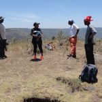
The Objective
This hike is all about movement—crossing from the old Nairobi–Nakuru highway to the new one. It is a journey of ups and downs. You climb Kijabe Hill, descend its eastern slope, then take on the long pull up Kinari Ridge before finishing at the new highway.
It sounds straightforward. It is not.
This hike suits a moderately paced hiker. Mixing slow and fast hikers often leads to one common mistake—reaching the Kinari forest at dusk. That is something you want to avoid.
The Trail: Kijabe Hill to the Railway Crossing
The route begins by following the Kijabe Hill trail up to the second railway crossing. Along the way, the old Lunatic Express snakes around the hill in wide, lazy curves—a reminder of the engineering madness that carved this path through the escarpment.
The Climb to Kijabe Hill Peak
The hike starts about 9 km from Mai Mahiu, just after the unmistakable IDP settlement. At 2,010 metres above sea level, the air already feels thinner.
Then the climb begins.
For the next two to three hours, you grind steadily uphill. No shortcuts. No tricks. Just step after step.
At 2,659 metres, you finally reach the peak.
You rest, take photos and breathe. You do what hikers do mid-hike where theres is not bathroom.
The Descent: Farms, Forest, and the Lunch Spot
From the peak, you drop down the eastern slope. The descent is quicker but no less demanding.
You pass the paragliding launch point—where others choose to fly instead of walk. Then come scattered farms and homesteads, before the trail dips back into forest.
Eventually, you reach a point near the railway line—your lunch stop.
By now, you have descended about 467 metres to roughly 2,192 metres above sea level.
If your timing is perfect, you will enjoy lunch under the trees.
It rarely is.
Along the Railway and Up Kinari Ridge
After lunch, you drop a few metres to the railway line. Then you follow it north for about 200 metres, just past the station.
This is your last easy stretch.
After a short breather, the real work begins again—the climb up Kinari Ridge.
The Kinari Challenge
Kinari does not give itself easily.
During the dry season, the trail is clear and forgiving. But in the rainy season, the bush fights back. Paths disappear. Tracks split. Progress slows.
You push through overgrown vegetation, following faint grazing trails, guessing your way forward.
Then suddenly, the bush opens up.
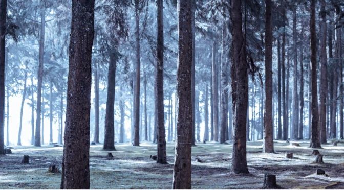
Wide stretches of Kikuyu grass roll ahead. You cross them and enter the cool, shadowy Kinari forest.
From here, the trail leads you toward Soko Mjinga—also known as the flyover.
Sunset and Soko Mjinga
If the weather is kind, the escarpment rewards you with a breathtaking sunset. The sky burns orange and gold as the valley falls into shadow.
It is a moment worth the effort.
Then you descend to Soko Mjinga, where roast maize often awaits.
But be warned—the name is not accidental.
Requirements
- Guide fee
- Forest charges
Guiding
Guides can be arranged through KENVO.
If you want, I can tighten it further, add a map-style route summary, or inject more humor like your Hell’s Gate piece.